Wednesday 18 September 2019

Rowfant Station

This is nothing to do with the Hawkhurst Line. I started working in a new role on Monday for a construction company a few miles east of Crawley in West Sussex, their premises are on the site of an old railway station and goods yard which was on the Tunbridge Wells to Three Bridges Railway, so I feel compelled to add it to this site for general interest purposes.
This railway was built in 1855 and it lasted for 112 years before the Beeching axe fell on it in 1967.
I heard that a rich American owned some of the required land which he refused to sell it unless a  station was built for his use (the place is very rural even today). Not surprisingly the station was hardly ever used and it became a 'white elephant' although trains were obliged to stop there.


            The old railway station hidden among the trees. (Taken from Wallage Lane.)


                                                    Was this once the main entrance?


More of the outside can be seen from 'Worth Way' a cycle path that runs most of the length of the line. This is looking towards East Grinstead. The track bed would have been the other side of the station.

On the business premises a lot of heavy lorries carrying aggregates pass over the old track bed, close to the station so I had to get permission to take pictures and wear a 'hi vis' jacket. The security guard (Andrew) was a very pleasant man from Hungary who chatted for about twenty minutes. He said that yesterday a coach load of train 'fanatics' has pulled up to look at the station. One of them was brandishing an original ticket. Andrew promised to email me the photo that he had taken, if he does I will add it to this posting.


The road is now some feet above the old track bed but the top part of much of the platform is still apparent.


There is a preservation order on the station site today but a closer inspection reveals that it could do with a coat of paint.


 All the widows are bricked or boarded up but it has not stopped a colony of bats settling there!


                This is looking towards Wallage Lane, Three Bridges and Crawley.


This seems to be the most imposing door, presumably this would be the way outside from the platform.


                                                              Or maybe this one?


              A part of the platform (just beyond the kerb) the bricks look fairly recent.

The work site includes an area that was once a fairly large goods yard, the area is very flat and long so I will try to find out if there is anything else left to see.

Image preview

Andrew told me that he was not able to find the ticket photo but he did send a photo of an old photo which is displayed in one of the offices.

Friday 13 September 2019

Would the Hawkhurst line be profitable today and various plans to extend the railway


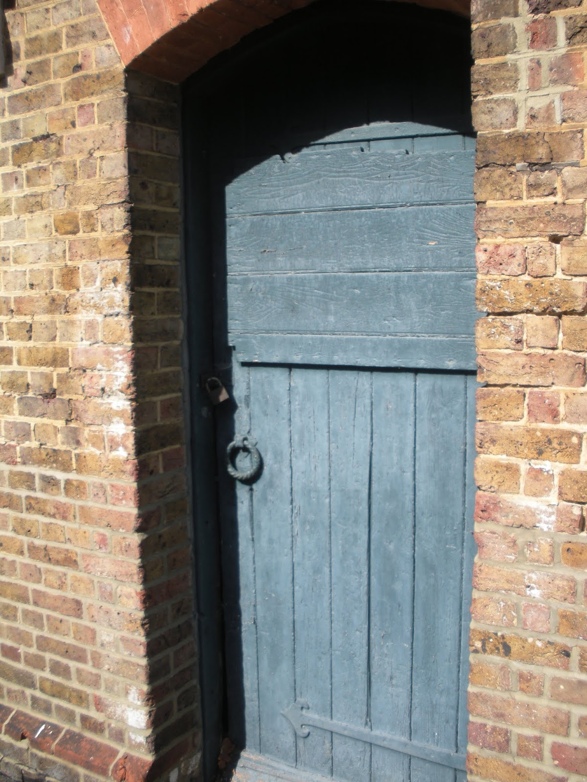
Hindsight is a wonderful thing if you have all the information to hand. I have no idea of what the running costs would be today of such an enterprise but can only look at the trends taking place up to closure in 1961. The railway had two income streams; passengers and goods.

Goods traffic was always the mainstay of this railway but today some commodities like coal are no longer used for heating purposes. The remaining railways have since been privatised and all the goods yards seem to have been sold off thus moving all the traffic onto the roads. It is nice to imagine that there would still be a fair amount of farm traffic if the line were still operating but I don't know whether it would still be feasible.

Passenger numbers were light for years, falling to just a couple of hundred a day by the end. I suspect that most of the passengers were travelling to and from work in London or perhaps Paddock Wood (I doubt whether many people were travelling from, for instance Goudhurst to Cranbrook (that is 1 mile from Goudhurst to 2 miles from Cranbrook). However, season ticket holder numbers seem to have been rising. In his book Brian Hart quotes the passenger and season ticket numbers for the years 1938 and 1949, these both showed an increase of 58%. Perhaps the economy was in a better shape after the devastation of the Second World War in that at least it was the start of thirty years growth without a recession. Although passenger numbers were to decline after this I do feel sure that season ticket numbers would have been gradually increasing as more people in these areas were prepared to make the sacrifice of a long commute for better paid jobs in London. My parents for example used all their savings to buy a house on the 'new estate' in Horsmonden because there was a railway station there and my father could get to work in Sevenoaks easily, but by the time the house was built in 1963 the railway had been closed! By the 1980's there must have been at least twenty people on that estate who worked in London (if our car was out of action we could always cadge a lift to Paddock Wood Station from our neighbour or the people over the road).. The 1960's 'baby boom saw two more estates go up in Horsmonden and I am sure similar changes happened in the other villages, so I really believe that if the railway existed today it would have four or five times the number of season ticket holders. 

---------

Brian Hart who wrote 'The Hawkhurst Branch' describes how as a young man and a volunteer on the fledgling  KESR heritage line he helped to remove some of the signalling from the Hawkhurst Line for use on the KESR and how he felt a sense of guilt doing it. During his time helping to reopen part of the KESR, British Railways wrote to them twice to ask why they did not concentrate on the Hawkhurst Line which was far more viable.


Possible Line Extensions

There were several ideas muted at the end of the Nineteenth Century some of which achieved parliamentary approval. Ambitious projects included terminating at Hastings, Rye, Windchelsea and even Dungeness! I wonder whether the future of the Hawkhurst Branch would have been a little rosier or not if any of the following extensions had taken place. Here are some of the more series proposals.


      Looking down the A299 in a southerly direction, a bridge was intended to be built to take
             the line across the road from Hawkhurst Station which once stood on our right.

1/ Hawkhurst to Appledore

This was be problematic to begin with as the ground appears to fall away to the east on the other side of where the bridge would be, so it would require extensive engineering in the initial stages. The Line was projected to run close to Benenden, Newenden, Sandhurst, Rolvenden, Tenterden (1.5 miles south of the town) and Appledore (this village already had a station connecting Rye and Lydd with Ashford). The full extension would have meant a further 14.5 miles of track. It must have been an exciting proposal, but looking at a map I do wonder how close to these communities the railway would have been, (perhaps they could have done Sandhurst, Newenden, Wittersham, Appledore but I do not know whether the topography would have allowed this.) Certainly Benenden and Tenterden would be too far north of the general direction of the railway.

Populations as at 2011 census

Benenden     2,374
Newenden       223
Sandhurst     1,478
Rolvenden    1,414
Tenterden      7,735
Appledore        800


2/ Hawkhurst to Etchingham

The village of Etchingham in Sussex already had a railway station on the Tunbrige Wells to Hastings line and was only six or seven miles from Hawkhurst station 'as the crow flies'. I think it would have been an engineer's headache to build the railway though as the track would have to turn south west which would have meant re-crossing the road further down. The engineers would be obliged to make quite a sharp turn so that the road is not crossed too far down the hill, otherwise enormous embankments would have had to be built to keep the line close to 'the level'.

Population as at 2011 census

Etchingham    1,187


3/ Hawkhurst to Hastings

This proposal was for a railway to Conghurst, Bodium Mill, Mill Corner, Brede Bridge, Doleham and Hastings (no I can't see these places on my road map even.) Again it would have meant crossing the road and somehow swinging south in the direction of Hawkhurst with the additional expense of building and manning stations in tiny hamlets.

Populations as at 2011 census

Conghurst          5? (has a farm!)
Bodium Mill      -
Mill Corner        -
Brede Bridge     -
Doleham            -
Hastings   88,000 (approx.)


4/ Cranbrook to Appledore

This would have meant that the line would branch just before Cranbook Station (leaving Cranbrook and Hawkhurst stations as a spur) before reaching Furnace Mill, Hendon Bridge (near Rolvenden), Redhill Bridge and Appledore. Once more the stations would have to be built and manned for tiny hamlets but hopefully this line would have required fewer earthworks in it's construction.

Populations as at 2011 census

Furnace Mill            -
Hendon Bridge        -
(Rolvenden)     1,414
Redhill Bridge         -
Appledore           800


5/ Cranbrook to Appledore (again)

This seems the to me to be the most commercially viable. (It would have run in an arc heading to the north east before veering to the south east after Sissinghurst.) The railway would part just before Cranbrook station and go directly into Cranbrook, near Sissinghurst, south of Biddenden, Tenterden, Reading Street and Appledore. (The original station site earmarked for Cranbrook had been close to the High Street and Stone Street to the south of the town, this would have been a perfect location for a station if they had been able to obtain the land to get there.) If they were able to build it the full length of this extension would be a further 16.5 miles leaving Appledore station at about 61 miles from Charing Cross Station.

Populations as at 2011 census

Cranbrook            6,717
Sissinghurst (a parish of Cranbrook)
Biddendon           2,574
Tenterden             7,735
Reading Street (a parish of Tenterden)
Appledore              800

------------


By 1900 the Kent and East Sussex Railway was opened from Headcorn via Tenterden to Rolvenden. This denied the Hawkhurst Line the prize of Tenterden and by then the appetite for building light railways was on the wane.

------------------------


Where would you have extended the railway to ?

For myself if I had been a director of the railway, I think that I would have swallowed my pride and tried again to extend the railway to Cranbrook and then I would wait to see how successful business was before inventing any more daring schemes.


Sunday 18 August 2019

Hawkhurst Station

Situated about 1 mile north of Hawkhurst and 1 1/2 miles south of Cranbrook Station, Hawkhurst Station became the terminus of the Line.
The Station site covered a vast triangular area, the southern end of which was on a kind of plateau to the A229 which ran to the east of it (so that at some point it could cross the road and continue in a South-Easterly direction. A lot of spoil from the cuttings between Hawkhurst and Cranbrook Stations (to the north) had been transported to level the sight. I feel it was an impressive feat of engineering, especially as the railway Company kept changing their mind about the direction of travel.

Hawkhurst Station had just one platform which had a Main Line and a Bay (so that it could serve two trains at once) there were also five or six sidings off to the west of the platform.

A drivers eye view of the site would begin first of all with  the sight of a twin arm signal (indicating which side of the platform the train would be directed) the train would then rattle over the last bridge at Slip Mill Road, pass the twin arm signals on the left, an old engine shed on the right and then a water tower and signal box also on the right. On the left would have been the expanse of the railway which was more industrial than the other stations. There would have been a number of sidings, piles of wood from the Kent Woodware Company that rented part of the site and tanks and outbuildings belonging to an oil Company that also rented a part of the site, and finally, on the left, close to the buffer stops, stood a goods shed.

Certainly by the late 1950's the whole site had a faded industrial look with lots of corrugated outbuildings (seeing it as a boy, Peter Harding was reminded of the 'Wild West'.) Nevertheless, Hawkhurst had more paying passengers than the other Stations (there were 104 season ticket holders in 1949) which was more than any other station) and as well as farm traffic, over 1 million pot plants a year were transported from local nurseries to Woolworths and M&S stores from here in the late 1950's and early 1960's.


A 1911 image of the main entrance to Hawkhurst Station, it was to change very little in 68 years.


Another early image from about 1920 perhaps? (automobiles have began to take over from horses). A 'Jeyes fluid' poster can be seen to the left of the picture while the water tower looms up in the distance on the right.


I'm guessing that this picture was taken during or just after the Second World War as a number of men seem to be in soldiers uniforms. I think the signals are the 'starting signals'. The building on the extreme left would be the signal box behind which would be the bulk of the water tower (you can just see the hose and a pool of water.) In the distance is the engine shed which could house two locomotives but it was only used for housing locomotives until the 1920's. 


31518? sits in the Station. Here you can just about see that unlike the other stations, Hawkhurst platform was faced with railway sleepers. The track on the left was a small 'loop' which allowed the locomotives to move around to the front of the train for the upward (return) journey. The small signal box and water tower can be seen a few hundred yards distant.


The train on the right is a goods train emerging from one of the sidings. In the distance can be seen some of the railway cottages that Holman Fred Stevens designed.


    11th June 1961, a number of well wishers look on as the last paying passenger train prepares to depart Hawkhurst Station.


                                                 -----------------------------------

Today there is very little left to see of the station. I popped over to take a look earlier today, in the rain!

Now all the station buildings have disappeared to be replaced by hideous industrial units (I won't depress the reader by showing images of that!)

However, until relatively recently the engine shed and signal box still existed, these can still be seen via Google earth where the van came around in 2009, please see the links below showing the signal box in the distance from Limes Grove and the engine shed from the railway cottages in Slip Mill Road:-

https://www.google.co.uk/maps/@51.0640413,0.5056636,3a,75y,180h,90t/data=!3m6!1e1!3m4!1sCLYn0yul3yzGmY7-1g8n4w!2e0!7i13312!8i6656

https://www.google.co.uk/maps/@51.0638179,0.5037407,3a,75y,90h,90t/data=!3m6!1e1!3m4!1s1AZ8BNExU4xzbL2_tcnzTQ!2e0!7i13312!8i6656


This was the track bed - looking up the line, before all the commercial units occupied the site, the platform would have been on our right with the buffer stops behind us.


This is now looking down the line to the final buffer stops which once stood where the hedge is about 40 metres away. I am told that before all these trees grew up, people could see a long way towards Romney Marsh from here.


The steps leading up from the road still exist together with a small sign which serves as an epitaph to the memory of the railway. An oil lamp once stood at the top of the steps and the station entrance would have stood a little to the left from the top step.


Another image of the steps. On the extreme left can been seen the embankment where the line would have joined a bridge over the A229, if it had been built.


Not looking anything like 126 years old, these stones would have to be able to support the weight of a full locomotive and carriages. 


This photo is looking south towards Hawkhurst, you can see how steeply the road drops down, far too steep for the train to get any closer to its preferred destination, leaving the station stranded a mile from the village. Notice also the embankment on the right, which gets progressively higher as the road drops. The bank in the distance is the embankment we just saw (the bridge was never constructed.)


As there is nothing left to see of the station I thought that I would take a look along Limes Grove which joins Slip Mill Road where the railway bridge once stood.


I believe that this is where the bridge once stood, although I could see no sign of any remains. There were actually two bridges built, a newer one was built in the 1950's to replace the older ailing one.


However, at the top of a bank further down Slip Mill Road I could see a pile of rubble hidden amid the trees.


           These concrete blocks and steel wires must be the remains of the second bridge.


Apart from finding a giant toadstool, I just accumulated a lot of green slime climbing the bank!


Monday 14 January 2019

Badgers Oak Tunnel to Slip Mill Lane


This side of the tunnel we are in the Rother Valley as we begin to descend at last (at 1 in 80).
It was about half a mile from Hall Farm Bridge to Badgers Oak Tunnel as we set off southward from the tunnel towards Hawkhurst Station site to see how far we are allowed to walk before we encounter a 'Private' sign.


The track bed is dead straight at first as we emerge from the tunnel to find ourselves in a fairly deep cutting. Beautiful!


           The tunnel, partially obscured by a fallen tree, seems a long way back already.


                                                               The cutting shallows out.


                            Old railway sleepers mark the original railway border.


                                Mixed with the earth and leaves is some railway ballast.


So far we have been going in a straight line, Badgers Oak Tunnel is back there in the distance.


I don't know what these bricks were part of? I do not believe that they were related to signalling, According to one book, Hawkhurst distant signal stood half a mile from the station but I do not think that the signals had brick bases.  There were plate-layers huts scattered along the line, perhaps this was the base of one?

Update May 2020. As per Lord Tantrums comment, this was a maintenance hut. It had largely been constructed from railway sleepers but it did have a brick chimney.


Two ancient fencing posts I discovered on my trip. Which is the oldest?


At the bottom of a steep embankment I spotted one of the culverts that carried water under the line circa 1893, I guess this one was about two feet in diameter (and water was trickling from it into a ditch.)


Getting back up the steep embankment was challenging though, fortunately I remembered some of the skills I learnt in boyhood!


This walk has taught me a lot about the heavy engineering that was required to build this line, the surrounding hills are constantly undulating, but these embankments and cuttings were doggedly created with spades, muscle and sweat. I do admire the Victorian engineers, they had a 'can do' attitude, nowadays despite all the wonders of modern technology, Network Rail would complain that it would be virtually impossible to undertake such an enterprise and be 'vastly expensive'.


                                 A view down from one of the higher embankments.


                                                                         But!


            Sadly a 'private' sign, gate, an awning and a caravan mark the end of the walk.

Checking Google maps later (after Richard's comment) I think we are close to Slip Mill Lane at a point about five hundred meters from the where the buffer stops stood. Usually I visit old parts of the line with some trepidation as I am often upset by the destruction that has taken place. Overall though I was very heartened today as I was probably able to walk for over a mile without encountering a fence or a 'keep out' sign. I would like to thank the landowners who obviously have an appreciation of history and who have generously allowed the public to visit this wonderful place.

Sunday 13 January 2019

Badgers Oak Tunnel (South end)


                                                       A view looking back to the North portal.


                                                      A view towards the South portal.


                        I did find one very rotten old railway sleeper in the tunnel.


                                   Another refuge. (There are only four altogether.) 


The engineer who marked out the sections of the tunnel was not the same person who marked out Horsmonden tunnel.


                                                           Yes, you've guessed it!


                                                          It is not so wet here.


                           (Looking north.) The curvature of the tunnel is quite noticeable here.


Outside the tunnel now, and again this tunnel has large retaining walls. (Horsmonden Tunnel has no retaining walls like this.) Here the tunnel number is displayed much more clearly showing no. 1532 (Horsmonden was 1472).


The South Portal is different from the North Portal and Horsmonden Tunnel! This has a four brick lining, I have never noticed this before or read about it. 


This tunnel has always had problems with water ingress, even during it's working life. There is an old photograph in Peter Harding's possession showing the tunnel being constructed from the North Portal, I suspect that the engineers began constructing with a three brick lining but switched to four bricks at some time during construction because of their concerns over water ingress. I would say that the wettest part of the tunnel is probably about a third of the way in towards the North Portal.


              The retaining walls keeping the banks in place are many bricks thick.


           It was quite possible to clamber up one of the retaining walls for another snap. Watching a steam locomotive bursting out of the tunnel would have made a wonderful photograph!


Above the tunnel one of the capstones has been pushed down onto the track bed. These large lumps of masonry must have been very heavy. Did the builders use a crane to get them in place? 


      What a view! Again from above the tunnel the line begins to descend at last at 1 in 80 on a straight line.


                   Point of impact! The remains of the other capstone on the track bed.


I feel that the tunnel will  become unsafe in a few more years if it is not maintained. I only found the remains of one old railway sleeper and there were no old rails that I could see.