Friday 19 June 2015

Goudhurst Station

In 1892 the station for Goudhurst was completed being 1 mile west and nearly 100 meters below the village, the site had been chosen just north of the A262 and adjacent to the River Teise. The station was named 'Hope Mill' after the water mill in the vicinity. A week after a Board of Trade inspection the station opened together with Horsmonden, and Hope Mill became the first terminus.
For the navies and engineers there was little respite as they had to build the line to Cranbrook within a short time before the act of parliament allowing the railway expired. In late Victorian times 'railway mania' had largely ran its course and the county was criss crossed with lines. There were several railway companies enviously guarding their patch of Kent, yet there were still three towns towards the south east of the county not yet served by a railway; Cranbrook, Tenterden and the small town of Hawkhurst, if they could extend the line another six miles to the centre of Cranbrook its economic success was almost assured, and if necessary perhaps the SER could then get other Acts of Parliament later to extend east towards Tenterden.


The day of official opening saw this Cudworth 118 bedecked in a union flag and hops arrive in September 1892.  Holman Fred Stephens (in white suit and bowler hat) poses with the driver and fireman, the curate of Horsmonden, immediately behind him with cane, who was ambivalent about the railway and 'would do nothing to oppose it' has also wormed his way into the photograph. 

                                                              ------------------------

A year after opening, the people of Goudhurst successfully petitioned the SER to change the name to 'Goudhurst Station'. The station was not a complete success due to the distance from the village it served, although a few private carriers began operating between the station and the village and people did expect to walk further in those days, still it served the local farms better.

                                                             ------------------------


A 1950's photo showing the end of the hop picking season where a crowd of Londoners are standing on the platform with their prams and luggage, about to catch the train home.


At 41.1 miles from Charing Cross and 6.3 miles from Paddock Wood Station most of the traffic was farm traffic although surprisingly they still managed to boast 43 season tickets holders by 1949.
Unlike all the other stations Goudhurst had two tracks and two platforms so that up and down trains could pass each other without hindrance. The Station Master's house, ticket office, signal box etc were all on the west (or up) platform.
At the back of the station were two goods sidings but unlike Horsmonden there was also a goods shed and crane.
To the south the railway crossed the A262 road via a level crossing and then ran on between the Green Cross Inn and Finchcocks Estate. Being the fourth level crossing heading south on the line it was also by far the busiest road. Behind the up platform stood the goods yard and crane, there were three sidings. The River Teise ran very close and crossed the line under a bridge just north of the platform. Apart from the road to the south, fields surrounded the station. Being much more exposed than Horsmonden Station it must have been idyllic in summer but unpleasant on a windy winters day.


Another early photograph of the station with some of the staff and passengers featured, there appears to be a lot of baggage stacked at the end of the platform. 


This photo is looking down the line from the down platform, it gives a good view of some of the original oil lanterns (not all of which were completely erect after nearly seventy years service).


These were to be the last paying passengers from the 'Farewell to Steam' event the day after official closure. Crowds appeared with cameras for the last ever train. If only the railway had regularly received this amount of patronage it would have survived.


This sad photograph (taken in the summer of 1962 or 1963) shows the station after a year or two of dereliction, the station and goods yard behind it was soon to make way for two large houses and a swimming pool.
                                                     -----------------------------

Two houses were built in the 1970's over the station and goods yard sites. I popped down there with a friend a few days ago and managed to snap a few pictures.


Looking north over the road and site of the level crossing to where the station once stood.


Two images to the south looking into the overgrown track bed. In the top one part of the crossing keepers cottage roof is just discerable. It seems strange today that the SER would build a house just to employ someone exclusively to open and close a level crossing gate a few times a day when there were other station staff working at the station. Today no doubt one person would be employed to perform numerous functions.


The above oasts (now converted to houses) appear in a lot of old photos of the station. I think I was standing just about on the site of the signal box when I took it (part of which would now be underneath the road which has subsequently been widened).


Above Paula outside the Green Cross Inn (this place features on an early twentieth century map of the station, although it was called something else fifteen years ago when the present owners took over). Inside the staff are pleasant and the pub specialises in seafood, there are a number of old photographs on the wall showing the station as it was.


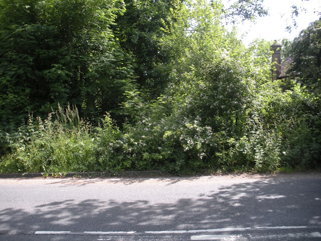
The trees on the extreme right border the track bed.


 The local's were very friendly too, especially as fish was on the menu. This cat was very well behaved actually he just hung around and feigned indifference but didn't pester us.


Two images looking into the sight of the track bed taken from the beer garden of the Green Cross Inn, (the line ran down here in a slight cutting, as soon it would cross under a bridge).


Thursday 18 June 2015

Smallbridge Level Crossing Horsmonden

About another 600 metres down from Brick Kiln Lane Bridge was the very narrow and quiet Smallbridge Road (presumably named after the small bridge that once crossed the Teise a little to the east). This is still just about within Horsmonden parish. A third level crossing was situated here, with the same style of crossing keepers cottage as those further north. This one, like the other two has had significant extensions added.


Looking west towards Smallbridge crossing site, the keepers cottage is on the left (south of the road).
The only sign of it's existence today is the raised road at the point where the level crossing stood.


And looking east, the bump in the road is less obvious here but the scratches on the tarmac from vehicle exhausts give testament to it's existence. Here the crossing keepers cottage is on the right. It was difficult to photograph as the occupants had allowed a high hedge to grow up. The vehicle in the distance parked up on a verge is mine, we actually met no cars at all while we were here.


Following the track bed north would take you through this garage towards Horsmonden. Apart from this section of private property the track bed is now all farmers fields to Brick Kiln Lane.


And south through this shed towards Goudhurst
The line ran very near the crossing keepers cottage and parallel to a field, it was on a slight embankment which must have been removed by the house owners at some point in order to be level with the rest of the garden. The google maps street view is much clearer as the garden was more open then, there had to be an embankment to compensate for the slight rise of the land to the south. After this section of private drive the track bed continues south to Goudhurst station site about 1,350 meters through farmland.


This is the adjoining farmers field looking south, you can see how the land rises slightly.


This is the only image that I could get of the crossing keepers cottage (if you are really interested, see Google street view for a better image). The central part of the house is the original. The finial at the top of the eaves has disappeared but the house is constructed of red brick and there is a bay window downstairs. In most cases the crossing keepers were expected to close the crossing gates to the road ten minutes before each train was due, but here the road was so quiet that there was actually heavier traffic on the railway. The gates were usually therefor shut to the road until a car arrived in which case I suppose the driver would have to hoot their horn to attract the crossing keeper's attention.


A few hundred meters east of the line is the River Teise the old 'smallbridge' appears to have been replaced with a modern bridge. This is looking south upstream, it is summer and has hardly rained so there is little water.


Above, looking north, downstream towards Horsmonden, as water streams over pebbles the iron in the soil is very apparent.

Tuesday 16 June 2015

Leafleting Paddock Wood station

 
It's a nice sunny day in Reigate.


And I'm going to the printers.
 

I have ordered 100 flyers for distribution tomorrow at Paddock Wood station. Hopefully there is enough information on here to arouse curiosity amongst Horsmonden commuters who have to travel by train every day. I'm actually quite a shy person so I don't enjoy thrusting myself upon people, but I hope people realise that the possibility of reopening is not a hopeless case and I think some people will take an interest.
 
Wednesday 17th - That was not too bad, (there was a lot more staff today than the Saturday I visited before) I began by approaching the ticket office and asked if I could leave leaflets at the station, but the man there said he will have to ask his boss who was not in for another 2 1/2 hours. I then asked about sixty people if they were from the Horsmonden area and seven or eight were, all were interested and all took leaflets, there could be a collective strength here if people really wanted the railway reinstated. Then the Station Master(?) came out and suggested I leave the remaining leaflets on a little table where other literature was available. One lady who came out and chatted with me was very encouraging which was much apprecited but said that actually parking was not a serious problem as she parks somewhere nearby for £2.50 daily (what will it be like when 650 more houses are built near the town though?).
----------------------------

If you took a leaflet today thanks for the interest. Like all of us I happened to be born in a particular time and grew up in a particular place, it happened to be in Orchard Crescent soon after the railway closed. As a result I grew up loving the railway; to me it is hallowed ground like Wembley, Wimbledon or Lords. I am not interested in any financial gain doing this.

------------------------------

If the line re-opened, the station would be the site of W Barge and Sons garage on the Goudhurst Road.

The line would head north rising slightly into a deep cutting (which was filled in during the 1960's and 1970's).

It would then run under the beautiful Back Lane Bridge (buried - see my earlier rant about this bridge) this was about the deepest part of the cutting.

The deep cutting would continue on to the tunnel (this part of the cutting is now buried and someone's garden, why??)

The 76 yard tunnel still exists, in pretty good condition and runs under the B2162 near the Cricket ground, this is the highest point.

North of the B2162 the line would emerge into a deepish cutting  (still largely in existence) dropping at 1 in 66 and roughly north and parallel to the Maidstone Road. After a few hundred meters the cutting becomes an embankment for half a mile crossing Swigs Hall Farm Bridge (both in very good condition) (a large tributary of the River Teise flows through a culvert under the embankment from the Furnace Lake).

At Yew Tree Green Road the line would run under a road bridge (now destroyed - why??) still dropping at 1 in 66 and run through four farmers fields via Rams Hill in an arc towards Churn Lane.

The line crossed the road via a level Crossing at Churn Lane.

More fields would be crossed through Beechland (formally August Pitts Farm) but the descent would be much less now.

Another dozen fields would see the line go near Old Hay Farm.

The very rural Willow Lane would be crossed next via a level crossing.

Shortly after that the line would go under Queen Street Bridge (now a hill - is the bridge still therebut burried?)

A few hundred meters later the line would bend round and run parallel to the  main Ashford line for the last 2/3 miles and arrive at Paddock Wood, south of the up (to London) platform.

-----------------

If you look at Horsmonden on Google maps you can see the direction that the track ran due to the line of the hedges and the slight colour differences of the soil.

If you have any questions please do ask me but I don't know everything.

Anyone can call Network Rail on 03457 11 41 41 and they can quote the case reference number 000246 to receive any updates on the case review.

I would urge you to consider buying a book about the Hawkhurst Line you should find it very interesting and well worth it - see my book reviews post.

As I say (whatever your political views are) please let Mr Clarke know your feelings about this so that he can do his job, you are after all the most important people here.

Finally, maybe I am being unfair but Horsmonden council do seen to have a poor track record in preserving the line and may be unenthusiastic about reopening, if it was to be successful they may need convincing.
 

Monday 1 June 2015

Back Lane Bridge (Originally Sandy Lane), Horsmonden

I am getting a bit more organised and hope to be working my way down the line from north to south soon. Back Lane Bridge has been missed out until now as I don't like discussing it; sadly its misuse by the local population is an appalling story.
Standing a few hundred meters south of the tunnel this little bridge connected a very quiet lane with a few houses and orchards to the rest of the village. It looked very innocuous until you looked down into the cutting about 45 feet below, there are no photographs. But looking up from the track bed (until the early 1960's) you would have seen a very high red brick bridge with three graceful spans supported on very tall piers. There is only one photograph known in existence (again in Brian Hart's book) which was taken from the track bed and looked like the bridge was 100 feet high although only train drivers would ever get to see it.

                                                              --------------------
Update of January 2017 
I have since discovered a 1958 drivers cab cine film of the bridge on YouTube and below are two screen shots as the train approached the bridge heading down towards Horsmonden Station shortly after leaving the tunnel.

image2.PNG

The train's funnel and dense vegetation obscure our view of the outer arches but it would have looked spectacular from the track bed.


image3.PNG

Even these pictures fail to give the full height of the structure as you cannot see the track bed because the camera was placed high up on the train. 


The full YouTube video can been seen using the following link but it only shows a couple of seconds of this rarely recorded bridge.

www.youtube.com/watch?v=PO69U5Blvxo

'Oh my God that's huge!'
Since I became aware of this footage I have contacted David Scully at Tunbridge Wells Borough Council archeology department who was amazed at the height of the bridge and will include this bridge on their database. He said that the council are taking the hop pickers project seriously and that way markers are starting to be erected in the Paddock Wood area allowing walkers to begin to walk the length of the line. He said that even Horsmonden parish council have been forced to take this seriously and that he recently walked the infilled cutting from the station site to the bridge.


Above a photo of Back Lane today, the cutting continued under about where the wooden fence was. Walking there now you may never imagine that there was a bridge here.

When complete there was a parapet a few bricks deep and about 4 feet six inches high on both sides of the bridge so that most adults could rest their elbows on the bridge when looking down. The sides of the cutting though were merely grassy banks with a sheer drop and I don't remember there ever being a fence up to protect people. In no time it seemed people were pushing old cars down there so that by the late 1960's there may have been thirty cars on top of each other at the bottom of the cutting. As boys we were told not to go down the cutting as it was dangerous, but it was also interesting and you may as well ask the world to stop spinning as ask boys to stay away from such a place. As young children we often went down there and it was dangerous but we found a way down anyway. Meanwhile for years the local village idiots (of which Horsmonden had more than its fair share) continued to push old cars and other rubbish onto the track bed and it quickly began to consume the bridge. (No body lifted a finger to stop this happening, no signs went up warning people off, no fences, not even a cordon of string, the council and locals did nothing. This may have partly a sympton of 1960's / 1970's attitudes, but still). From this point onwards the collective memory of the railway receded and it was just known as 'the dump'. Strangly, now fences have appeared 40 years too late.
It was quite common every summer for fires to start, there would be black smoke billowing up into the sky and then the fire brigade would have to come out and the police. In the 1960's and 1970's it was fair game for adults to dismiss these events as the work of 'stupid kids,' but looking at it logically now it was probably usually caused by the sun shining on broken glass in the cutting and igniting combustible materials (left there mostly by mindless adults). All the track bed south of the bridge to the station site which was owned by Mr W Barge was being filled in with tipper trucks full of rubble from the early 1970's.onwards.


 One good thing did happen though, the local plastics factory made subuteo figures, these were also painted on site. Some of the figurines failed the quality control and someone had dumped the sub standard ones from the bridge. It was not long before word got around that there were free subbuteo figures and it was a boy magnet all around the village. I myself remember scrabbling through the dust and mud (the smell of verdancy had long gone and it smelled like a dump then) looking for Coventry City, Derby County and Wolves players, unfancied teams today perhaps but all Division One teams from about 1974. I remember looking up at the arches of the bridge which began to curve only about eight to ten feet above our heads at this time.


,
This is all that is left of the parapet at the top of the bridge which curved outwards slightly so that the road was fractionally wider at each end. Someone has been employed to destroy the parapet of this wonderful bridge with a sledge hammer, why on earth, it doesn't make the road any wider.

Not much changed after that except there was a rat infestation because local villagers kept throwing their food waste off the bridge (as well as other rubbish) which attracted hordes of rats. Today there is no visible sign of the bridge, the cutting is full all the way from the near the tunnel's southern portal to Horsmonden Station site and as a result all the commuters will have to carry on driving to Paddock Wood as they may never get their station back. A big house has now appeared within a stone's throw of the tunnel and the whole track bed is somebody's garden. Personally I really hope the cutting is re-excavated and the garden disappears again forever. This beautiful bridge deserves so much more respect than the wreckers at Horsmonden parish council and non thinking locals have given it.


Above a view from Back Lane looking across the school playing field towards the trees that lined the cutting south of the bridge. One summers day I remember eating my school dinner watching one of the fires and flames were leaping up the trees perhaps 20 feet in the air.


North of the bridge, this was once a deep cutting (wide enough for two trains) but now covers part of someone's extensive garden, the trees in the foreground were part of the bank and underneath the fence the bridge still exists together with perhaps fifty old cars.

A few months later in early August I popped over to take a look at what had been the cutting south of Back Lane Bridge before it was filled in during the 1970's. This patch of track was quite remarkable due to it's depth (up to 55 feet) and it extended for about 500 metres to the station site. It is now colonised by blackberry briars and stinging nettles, a haven for moths and butterflies no doubt.

Above, looking north towards the site of Back Lane Bridge, it is hard to tell due to the plant life but the whole lot has sunk a few feet down into what was the cutting over the last thirty years so it is still possible to discern the sides of the cutting. Here the line had been built wide enough for two tracks so Wally Barge must have made a fortune from all the tipper trucks that came to dump their rubbish. I had hoped that the ground would have settled exposing a little of the south side of the bridge but I underestimated how overgrown it had all become making it difficult to get to.


This would have been the eastern bank of the cutting, beyond the trees would have stood apple orchards.


Looking south into the jungle towards Horsmonden Station site. Remember, this was a deep cutting. In 1961, beyond a belt of trees there were apple orchards all along on the east side and cherry orchards to the west. I believe that filling in this cutting has been the single biggest act of destruction to the line, ensuring that probably no trains will ever run here again. As Network Rail pointed out the costs of re excavation would be huge.


----------------

By the early 1980's the cutting was virtually filled in, and local residents received notice of a request for planning permission to build a street of houses on top of the track bed! everyone was angry and my father went around all the houses seeking support for all his objections. (I don't think that it was ever going to go through because the soil was still unsettled and the builders would have to underpin the houses which would have cost a fortune). I remember going to a council meeting in Paddock Wood with my father and half the anxious residents of the estate, where the application was rejected.

Some weeks later Wally Barge did come to our house and dissapeared ino the lounge with my father to 'make peace' as that he wanted to be on good terms with the community if possible.